Byzantino-Serbian Border Zones in Transition: Migration and Elite Change in pre-Ottoman Macedonia (1282–1355)
Description
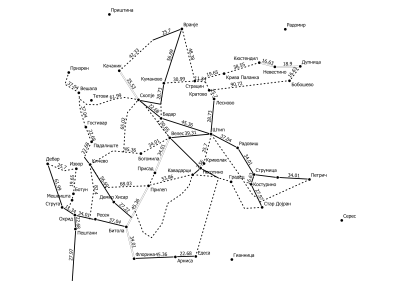
The European continent as a whole and the European Union in particular are facing a period of increasing dynamics of internal migration as well as external immigration at the moment. Migration in all of its various aspects has always been a part of the history of the European continent. In medieval societies the question of migration is closely connected with the definition as well as the representation of medieval borders. Maps in historical atlases are designed to provide clear-cut lines of political formations and empires, which does not reflect the reality of civilizations neither in Antiquity, nor in the Middle Ages, nor in Early Modern Times. The dynamics of borders simultaneously shapes the dynamics of settlement patterns as well as of transportation networks.
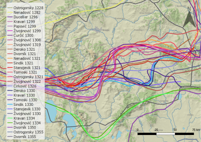
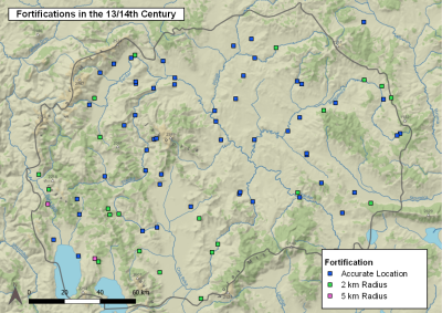
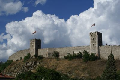
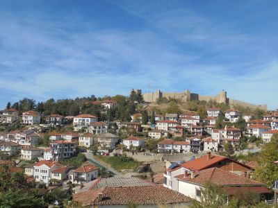
The respective stand-alone project focuses on the borders of the Byzantine (Eastern Roman) Empire in medieval South-East Europe, namely in pre-Ottoman (i.e. Byzantine) Macedonia. Far-reaching political changes occurred in the Southern Balkan Peninsula from the end of the 13th until the middle of the 14th century, when the Serbian medieval kingdom expanded to the South under the king Stefan Uroš II Milutin at the expense of the Byzantine Empire, which lasted until the death of tsar Stefan Uroš IV Dušan (1355). This again had a severe impact on the border zones and cross-border societies between both realms in pre-Ottoman (i.e. Byzantine) Macedonia in the same period, especially in five selected target areas (the Strumica Valley, Lesnovo, Skopje, Ohrid, Prilep).
Although substantial publications exist on the population of as well as on the migration in Byzantine Macedonia, there is still an urgent need for this kind of research based on written sources and toponyms. Two interrelated research questions will be addressed in two distinct work packages: "Rivalling Political Concepts – Byzantium and the Medieval Serbian Oecumene” and "Cross-Border Societies and Elite Change in Byzantine Macedonia”.
The initial point form the medieval written sources, i.e. Serbian and Byzantine charters as main corpus, as well as other selected written sources from the medieval Serbian kingdom. The sources will be analysed from the viewpoint of the aforesaid research questions and strongly based on the methods deriving from Historical Geography. Special attention will be given to the analysis of formulations with regard to the Serbian expansion in the area of research, the acquisition of new territories and their administrative incorporation on the macro-level and to the localisation of conquered settlements with related settlement typologies as well as on the change of local elites on a micro-level. Moreover, tools from Digital Humanities in mapping and visualisation will be applied in order to communicate the achieved results to the interested public.
Media
Explore
The access and use of our data is subject to the Creative Commons License CC BY 4.0 International (https://creativecommons.org/licenses/by/4.0/deed.en).


